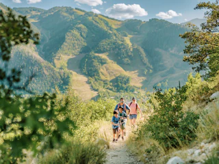


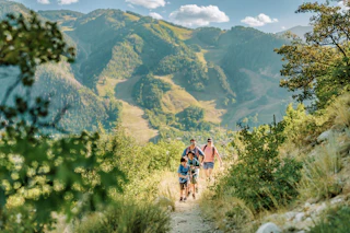


Lower Elevation Hikes in Aspen
After the slopes close for the season, step into spring by exploring Aspen’s lower elevation hiking trails.
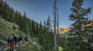
All promising scenic beauty, Aspen's trails offer diverse terrain, ranging from steep mountain climbs to paved, riverside paths. While snow remains on higher elevation trails, and many are not passable until late summer, explore the lower elevation trails this spring.


Rio Grande Trail: Running alongside the Roaring Fork River, the Rio Grande is full of natural beauty. The trail begins behind the Post Office on Puppy Smith Street and runs all the way to Glenwood Springs, spanning 42 miles. With a mostly paved surface and gradual slope, the Rio Grande is ideal for a family walk or bike ride. Bikers can ride from Aspen to the Woody Creek Tavern and enjoy a tasty lunch and refreshing drinks on their outdoor patio before riding back to town or hopping on the RFTA bus.
Difficulty Level: Easy
East of Aspen Trail: One of Aspen’s more gradual and scenic paths, this trail parallels the Roaring Fork River southeast of Aspen. The trail is popular for mountain biking, road biking, walking, running, and hiking and is dog friendly (pets must be on a leash).
Difficulty Level: Easy

Ashcroft Ghost Town: From Ute hunting grounds to a silver mining town to a world-renowned ski resort, Aspen has a rich history. The Ashcroft Ghost Town trail gives hikers the chance to step into Aspen’s past by exploring historic log buildings. The trail meanders through alpine meadows and sits alongside Castle Creek, offering stunning mountain views.
Difficulty Level: Easy
Smuggler Mountain Trail: Aspen’s quick “lunchbreak” hike, loved by locals, is one of the most popular recreational hikes in the Aspen vicinity. At every step, hikers and bikers are rewarded with panoramic views of Aspen and the surrounding mountains. The trail remains busy throughout the year and is dog friendly, allowing watchful off-leash play.
Difficulty Level: Moderate

Hunter Creek Trail: Conveniently located just outside of downtown Aspen, the Hunter Creek Trail gradually ascends the Hunter Creek Valley, boasting stunning views of Aspen and the Elk Mountain Range from the top. As a popular, centrally located trail, it is heavily used by mountain bikers and hikers and allows dogs on a leash.
Difficulty Level: Moderate
Red Butte Trail: Located near downtown Aspen, the Red Butte Trail climbs along Red Butte Mountain. The trail offers picturesque views of the entire valley, including downtown Aspen, the Aspen Golf Course, Pyramid Peak, and Mount Sopris.
Difficulty Level: Moderate-Difficult

Sunnyside Trail: This scenic trail boasts beautiful views of the surrounding mountains and city as it winds through wildflowers and aspen groves. Located on the outskirts of Aspen, Sunnyside is popular for mountain bikers and hikers with dogs and connects to the Hunter Creek Valley. The trail is steep and has limited shade, so make sure to bring plenty of water.
Difficulty Level: Difficult
Know before you go and check trail conditions in advance to avoid mud or snow.
Explore responsibly and help preserve Aspen’s natural beauty for years to come by following the 7 Leave No Trace Principles and taking the Aspen Pledge.