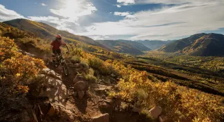
An IMBA Gold Level Ride Center, Aspen and the surrounding area provide spectacular and sometimes quite challenging terrain for mountain bikers.
Mountain Biking
IMBA Gold Level Ride Center
In 2020 Aspen Snowmass Roaring Fork Valley was awarded Gold Level Ride Center Status by International Mountain Bike Association (IMBA). Check out our Valley Partnership with Roaring Fork Mountain Bike Association and the Aspen Snowmass Epic Loop.
Everything you need to know about Aspen's IMBA Gold Level Ride Center status.
Below is a list of trails from easy to difficult rides. Some things to remember: mechanized vehicles are not allowed within the wilderness boundaries and this includes mountain bikes - keep in mind, three-fourths of the Aspen district is comprised of wilderness area - so use this list below for available rides. For additional information, please call the local Forest Service office at 970-925-3445 or visit the National Forest website.
A map of hiking and biking trails, historic sites, fishing easements, parks, and more in Pitkin County is now available online and via a free mobile app. Check out the site here or download the app: Pitkin Outside.
Aspen Trail Finder is a great resource for trails, maps, and current conditions, including pictures.
Mountain Bike Trails
Smuggler Mountain Road - Follow Neal Street to King Street to Park Street to Smuggler Mountain Road where the trip begins. At the fork in the road (approximately 1 ½ miles), take a left. This road travels uphill for one and a half miles to the Smuggler Observation Deck. Going left will connect you with an entire network of trails: Smuggler Mountain Road to Hunter Creek Trail and Smuggler Mountain Road to Lenado Trail.
Rio Grande Trail - This trail begins behind the Post Office on Puppy Smith Street. The first two miles are paved. The trail then crosses Cemetery Lane becoming a dirt trail at that point. The trail proceeds northwest to Woody Creek (EASY). With only 24 hours in Aspen, we recommend biking to Woody Creek Tavern for lunch.
Sunnyside Trail - The trail begins on Cemetery Lane. Follow Cemetery Lane from Hwy 82 where the road crosses the Roaring Fork River. Approximately ¼ mile beyond this point, you will see the trail beginning on the right.
Brush Creek/Government Trail - The trail begins behind the tennis courts on Maroon Creek Road. It crosses Buttermilk Mountain and finishes in Snowmass. As this trail crosses private property, it is VERY important that bikers stay on the trail only. Failure to do so could jeopardize future use of this trail.
Sky Mountain Park - A 2,500 acre area made up of the Droste Parcel and Brush Creek Ranch which connects Aspen and Snowmass Village. There are 3 main access points: Buttermilk Ski Area, Brush Creek Intercept Lot and Snowmass Village Town Park. Check out our 360 tour on this awesome trail system.
Summer Road - The road that runs up the face of Aspen Mountain. Biking is allowed on the road only.
Aspen's neighboring town Snowmass Village has a variety of mountain bike trails to offer, some of our favorites include the Rim Trail, Tom Blake Trail, and the Government Trail. Click here
With 25 miles of chairlift access purpose-built trails and almost 3,000 vertical feet, the Snowmass Bike Park has rides for all skill levels.
Adventure & Recreation
Uphilling in Aspen
Uphilling offers a rewarding way to experience the slopes. From the learning basics to getting the scoop on exciting events, check out our guide to uphilling to learn the ropes before earning your turns.
Aspen Winter Bucket List
Skiing and snowboarding on Aspen's world-class slopes may be #1 on the bucket list, but the fun doesn't stop there. Get the most out of this winter season in Aspen and see how many items you can check off of our winter bucket list.
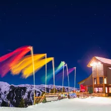
Guest Blog: 3 Tips For Making Aspen Gay Ski Week The Best Week Ever
Aspen Gay Ski Week is a week-long celebration from Jan. 11-18, 2026 with a full lineup of events, including comedy shows, pool and dance parties, friendship dinners, and, of course, skiing on all four mountains. We caught up with the experts of Men’s Vows for tips on making Aspen Gay Ski Week the best week ever:

