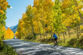
Road biking in Aspen offers smooth pavement, gorgeous scenery, and rewarding climbs through some of Colorado’s Rocky Mountains. Whether you're tackling Independence Pass or cruising along quieter valley roads, every ride promises views and oppertunity to challenge yourself.
Road Biking
Road Biking Routes
Maroon Bells - This road begins west of town on Hwy 82 at the second traffic light out of town. The road takes you a distance of approximately 10 miles to the beautiful Maroon Bells. There is light traffic on this road in the summer as it is only accessible by bus between the hours of 8am and 5pm making it a rider's paradise; showcasing vistas of Pyramid Peak as you wind your way to the top.
Distance: 10 miles one way
Estimated Time: 1 Hour Up
Elevation: 9,580ft.
Rider's Tip: Between the hours of 8am and 5pm this route is closed to vehicle traffic with the exception of busses. It's a riders dream!
Points of Interest: T Lazy 7 Ranch, Maroon Lake
DIFFICULT
Ashcroft/ Castle Creek Valley - Follow Hwy 82 west from Aspen. Go to the round-a-bout and take the Castle Creek Road exit. Approximately 11 miles up on the left will be the ghost town of Ashcroft. The road remains paved for about 1½ miles beyond that point. Castle Creek provides the sound track to your ride among the Aspen Groves.
Distance: 12 miles one way
Estimated Time: 1 Hour Up
Elevation: 9,500ft.
Rider's Tip: Watch for wildlife on this route, you may get to see bear cubs or elk from the safety of your bike seat.
Points of Interest: Ashcroft Ghost Town, Pine Creek Cookhouse
DIFFICULT
Independence Pass - Heading east from Aspen on Hwy 82, the road climbs to the top of Independence Pass (12,095 ft.). The trip to the top is approximately 20 miles, passing the ghost town of Independence on the way. Please be extremely careful as this road is very narrow and has car traffic in the summer.
Distance: 20 miles one way, riders can turn around at any point and come back to town.
Estimated Time: 2 Hours Up
Elevation: 12,095ft.
Rider's Tip: Best to ride this route during the weekdays as weekends have a higher volume of car traffic on the narrow winding road.
Points of Interest: USA Pro Challenge featured this climb in 2011, 2012, 2013 and 2015 races, Independence Ghost Town, & The Grottos Ice Caves
DIFFICULT
Old Snowmass & The Monastery: Follow Hwy 82 west from Aspen. Take a right at the stop light onto Cemetery Lane. Cemetery Lane becomes McClain Flats road showcasing views of the entire Aspen/Snowmass Valley. McClain Flats becomes Upper River, followed by Lower River Road. Lower River Road will dump you out at a stop light intersecting Hwy 82. Cross over the highway and follow Snowmass Creek Road until it intersects with Capitol Creek Road. Follow Capitol Creek Road until the Monastery. Trace your steps back to town. A lengthy rolling scenic route makes this a ride not to be missed.
Distance: 30 miles
Estimated Time: 3 Hours Round Trip
Elevation: 7,908ft.
Rider's Tip: On the way towards the Monastery from town you will think the return trip uphill will be grueling, but it's not as bad as you imagine.
Points of Interest: Woody Creek Tavern, Old Snowmass Monastery
MODERATE
Ride like the Pros - In 2013 Aspen & Snowmass Village hosted a 66 mile circuit race (three 22 mile laps) for stage 1 of the USA Pro Challenge. Should you feel so inclined to take on the route just like Chris Froome, Peter Sagan, Tejay Van Garderen and others here is the route information:
Riders started on Main Street (Hwy 82) in front of Paepcke Park heading west out of town through the S-curves, past the roundabout and continued on Hwy 82 to Owl Creek Road, where they took a left and traveled on Owl Creek Road until Brush Creek Road. (Note that at the base of the steep descent on Owl Creek Road, there is a left turn, don't take it and continue straight. If you end up on Highline Road you have missed the turn off). At the Intersection of Brush Creek Road and Owl Creek Road the riders turned right onto Brush Creek and continued down making a left onto Medicine Bow Road. Look for a right hand turn onto Upper Ranch Rd which then runs into Juniper Hills Road which crosses over Highway 82 onto Smith Hill Way. Continue up Smith Hill Way & heartbreak hill until you reach McClain Flats Road. Continue the length of McClain Flats which runs into Cemetery Lane. Near the top of Cemetery Lane make a left hand turn onto Power Plant Road which then turns into Smuggler Street. Continue down Smuggler Street making a right onto First Street traveling 3 blocks until taking a left onto Bleeker Street. On Bleeker travel 4 blocks until you reach the intersection with Mill Street, turn right onto Mill and then another right onto Main Street. This is a 22 mile loop and the riders raced this loop for 3 laps.
Adventure & Recreation

Uphilling in Aspen
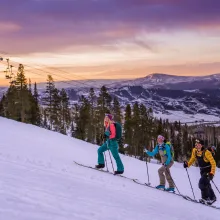
Uphilling offers a rewarding way to experience the slopes. From the learning basics to getting the scoop on exciting events, check out our guide to uphilling to learn the ropes before earning your turns.

Aspen Winter Bucket List
Skiing and snowboarding on Aspen's world-class slopes may be #1 on the bucket list, but the fun doesn't stop there. Get the most out of this winter season in Aspen and see how many items you can check off of our winter bucket list.

Guest Blog: 3 Tips For Making Aspen Gay Ski Week The Best Week Ever
Aspen Gay Ski Week is a week-long celebration from Jan. 11-18, 2026 with a full lineup of events, including comedy shows, pool and dance parties, friendship dinners, and, of course, skiing on all four mountains. We caught up with the experts of Men’s Vows for tips on making Aspen Gay Ski Week the best week ever:

